David Uttal: Maps, Space, and Place
David Uttal was 13 years old when he took a wrong turn on a hiking trail in the Blue Ridge Mountains. Rescuers searched for him on foot, trail bike, jeep, and by air, probing thick underbrush and steep ridges across 60,000 acres.
When they finally found Uttal, 50 hours later, he was cold and shaken but safe. And perhaps not surprisingly, he soon had a new interest: Maps.
Uttal, the Kenneth F. Burgess Professor at Northwestern University’s School of Education and Social Policy, is now one of the world’s leading scholars on maps, space, and place.
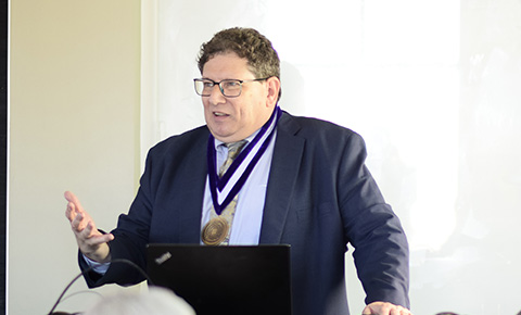
“My interests have always been about maps and other visual representations,” said Uttal, who traced his academic journey during his April investiture ceremony in Annenberg Hall, an honor bestowed on Northwestern University’s most outstanding researchers and instructors. “Maps open the world, allowing us to think about it in ways that would be impossible based on direct experience alone. Maps create our world - at least the world as we know it.”
Uttal, a developmental and educational psychologist, is jointly appointed in the School of Education and Social Policy and the Weinberg College of Arts and Sciences. His work emphasizes the connection between the importance of spatial representations and visualizations to science, technology, engineering, and math (STEM), his work blends psychology, learning sciences, anthropology, geography, and several other disciplines.
“Learning sciences has helped the entire field become ‘enlightened,’” he said. “We’re moving beyond the lab, looking at how society and culture influence psychology. We’re finally relevant -- studying things like climate change, bias, misinformation and how to resist it.”
Uttal began reading maps in the back seat of his father’s car not long after his scare in the mountains. He father, a botanist, was the curator of the herbarium at Virginia Tech in Blacksburg, Virginia where he grew up, and the two would collect plants during the summer.
“The maps left me with such a sense of wonder,” Uttal recalled. “My father wasn't that good at navigating either, but together we made it happen and the discovery stayed with me.”
Maps, he says, are representations of place. Space exists independent of people; it would exist whether humans are there or not. And place is what we bring to a physical space.
Spatial skills, which involve visualizing, transforming, and manipulating space and objects, play a critically important role in children’s learning and development, according to Uttal’s work.
“Maps have become so ubiquitous in our thinking that they are now a model for how we think about space,” he says. “People drive into water based on what the GPS says. We experience the world as much or more through maps as our eyes, ears, and skin.”
At Northwestern, Uttal leads the Spatial Intelligence Learning Center, a research lab focused on symbolic representation, informal learning, and spatial thinking in STEM education. Comprised of faculty, post-doctoral, graduate students and undergraduates, his team collaborates with schools, museums, and universities across the country.
One of Uttal’s biggest findings is the idea that spatial cognition is malleable, training or experience can make a difference. He has also shown that children as young as preschool can learn spatial thinking skills.
In one analysis, he and his coauthors reviewed more than 200 studies that looked at spatial training in a variety of contexts–everything from playing video games, to designing dresses–anything that was spatially demanding.
“Children who do well at spatial tasks such as reading maps and assembling puzzles are more likely to excel in science, technology, engineering. and mathematics (STEM),” Uttal said. “We know it’s important, but few people teach it. We're trying to change that. And our work suggests that education and experience can be highly effective.”
Working with collaborators at Georgetown University, James Madison University, and Dartmouth University, he has shown that high school students enrolled in a year-long course on spatial problem solving demonstrated cognitive and neural changes. This suggests that they now looked for spatial solutions to a variety of new problems.
Last year, Uttal and colleagues received a $100,000 award in the annual Tools Competition to develop an interactive platform that helps students and teachers learn spatial and math skills by using intricate and familiar patterns found in the natural world.
His class Mapping and Spatial Analysis for Social Issues, explores using maps and mapping technologies to address issues of diversity, equity, inclusion, and access to fresh food or health care. Students learn to use Geographic Information Systems (GIS) to create maps to understand and analyze the problems and suggest solutions.
Unlike a paper map, GIS can be altered and represent anything with data, including conservation areas, well locations, road network and vegetation.
“Evanston, like most cities, has literally hundreds of datasets publicly available. Anything you ever wanted to know about how water flows in Evanston, where you should build your new house, and whether there's a pool nearby, all those things can be layered on a GIS map.”
In 2021, Uttal was awarded four grants worth $1.28 million to study new ways to enhance spatial thinking, the process of looking for patterns in the relationships between objects. All four grants–three from the National Science Foundation and one from the Institute of Education Sciences– emphasize that spatial thinking is malleable, and that “playful learning” is the best way to teach the skills.
His newer lines of work include bringing social, behavioral, and economic perspectives to issues related to climate change, and to collaborate with other disciplines on mapping projects in native areas. Maps played a vitally important role in colonization, he said, and they could play a role in doing something about that.
"These maps in a sense, erase not only the validity of Indigenous peoples claims to the land, where they have here for centuries but also the very existence," Uttal said. "It has been said maps 'create and colonize' and we want to be part of finding solutions."
Photo: David Johnson